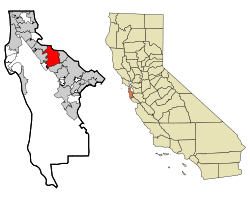
San Mateo, California
| City of San Mateo | |
|---|---|
| — City — | |
 |
|
 |
|
| Coordinates: | |
| Country | United States |
| State | California |
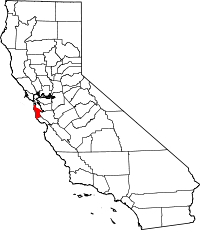
| County | San Mateo |
| Incorporated | September 4, 1894 |
| Government | |
| - Mayor | Brandt Grotte |
| - City Manager | Susan Loftus |
| Area | |
| - Total | 16.0 sq mi (41.3 km2) |
| - Land | 12.2 sq mi (31.6 km2) |
| - Water | 3.7 sq mi (9.7 km2) 23.43% |
| Elevation | 43 ft (13 m) |
| Population (2000) | |
| - Total | 92,482 |
| - Density | 7,569.5/sq mi (2,922.1/km2) |
| United States Census Bureau | |
| Time zone | PST (UTC-8) |
| - Summer (DST) | PDT (UTC-7) |
| ZIP codes | 94401-94404 |
| Area code(s) | 650 |
| FIPS code | 06-68252 |
| GNIS feature ID | 1659584 |
| Website | http://www.cityofsanmateo.org/ |
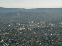
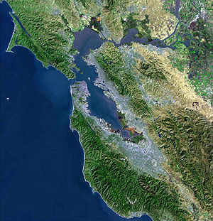
San Mateo (pronounced /ˌsæn məˈteɪoʊ/) is a city in San Mateo County, California, United States, in the San Francisco Bay Area. It is one of the larger suburbs on the San Francisco Peninsula, located between Burlingame to the north, Foster City to the east, and Belmont to the south. San Mateo was incorporated in 1894.
Contents |
History
Originally part of the Rancho de las Pulgas (literally "Ranch of the Fleas") and the Rancho San Mateo, the earliest recorded history is in the archives of Mission Dolores. It indicates in 1789 the Missionaries had named a Native American village along Laurel Creek Los Laureles or the Laurels (Mission Delores, 1789). An 1835 sketch map of the Rancho refers to the creek as arroyo de los Laureles, but by now most of the Laurels have vanished.
Coyote Point was an early recorded feature of San Mateo in 1810. Beginning in the 1850s some wealthy San Franciscans began looking for summer or permanent homes in the milder mid-peninsula. While most of this early settlement occurred in adjacent Hillsborough and Burlingame, a number of historically important mansions and buildings trickled over into San Mateo.
A.P. Giannini, founder of the Bank of Italy (that became Bank of America), lived here most of his life. His mansion, Seven Oaks, currently in disrepair and listed in the National Register of Historic Places (No.99001181), is located at 20 El Cerrito Drive.

The Howard Estate was built in 1859 on the hill accessed by Crystal Springs Road. The Parrott Estate was erected in 1860 in the same area, giving rise to two conflicting names for the hill, Howard Hill and Parrott Hill. After substantial use of the automobile by about 1935, neither name was commonly applied to that hill (Brown, 1975). The Borel estate was developed near Borel Creek in 1874, with present uses being modern offices and shops; the property is still managed and owned by Borel Place Associates and the Borel Estate Company.
Scholars Cottage, at 37 E. Santa Inez Avenue, was built by Ernest Coxhead in 1875 in the Tudor Revival style. The Eugene J. De Sabla Teahouse and Tea Garden was established in 1900 at 70 De Sabla Avenue, designed by Makoto Hagiwara. It exists today as a garden of a later home, and it features rock art and other sculpture.
"Hayward Park," the extraordinary 1880 American Queen Anne style residence of silver and banking millionaire Alvinza Hayward (often said to be "California's first millionaire"), was built on an 800-acre (3.2 km2) estate in San Mateo. The property, which included a deer park and racetrack, was converted into a hotel after Hayward's death in 1904. It burned in a spectacular 1920 fire.
Geography
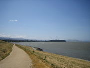
Perhaps the best-known natural area is Coyote Point Park, a rock outcropped peninsula that juts out into the San Francisco Bay. The early Spanish navigators named it la punta de San Mateo (Brown, 1975), but cargo ships carrying grain in the bay renamed it Big Coyote (BLM, 1853). In any case sailors had a penchant for naming promontories at the edge of San Francisco Bay after the coyote, since across the bay in Fremont are the Coyote Hills, part of Coyote Hills Regional Park. By the 1890s the shore area was a popular beach called San Mateo Beach, originally named by the Spanish in 1842 as playa de San Mateo. Today Coyote Point is home to the Coyote Point Museum, one of the best natural history museums and wildlife centers in California. The Peninsula Humane Society is also situated at Coyote Point.
There are a variety of natural habitats present, including mixed oak woodland, riparian zones and bayland marshes. One endangered species, the California clapper rail, was sighted feeding on mudflats by the Third Avenue bridge in San Mateo (Pfeifle, 1980). The marsh areas are also likely habitat for the endangered Salt Marsh Harvest Mouse, who enjoy the middle and high zones of salt and brackish marshes, as well as for the endangered marsh plant, Point Reyes bird's beak.
Sugarloaf Mountain, whose name traces back to at least 1870, is a prominent landform between the forks of Laurel Creek (Brown, 1975). In late 20th century, this mixed oak woodland and chaparral habitat was a site of controversy involving proposals to develop a portion of the mountain for residential use. Today it is park and open space area and home to the endangered Mission Blue Butterfly.
San Mateo is located at (37.554286, -122.313044)[1]. According to the United States Census Bureau, the city has a total area of 16.0 square miles (41.3 km²), of which, 12.2 square miles (31.6 km²) of it is land and 3.7 square miles (9.7 km²) of it (23.43%) is water.
Climate
San Mateo enjoys a mild Mediterranean climate, shielded from the Pacific Ocean by the Montara Mountain block of the Santa Cruz Mountains. There is a gap in the mountains, west of the College of San Mateo, where State Route 92 meets State Route 35, resulting in gusty afternoon winds and allowing fog to flow toward San Mateo in the late afternoon through early morning in the summer months.
The National Weather Service maintained a cooperative weather station in San Mateo until 1978; records for the period show that January, the coolest month, had an average maximum of 57.8 °F (14.3 °C) and an average minimum of 41.7 °F (5.4 °C), and September, the warmest month, had an average maximum of 78.0 °F (25.6 °C) and an average minimum of 54.2 °F (12.3 °C). The record maximum temperature was 109 °F (43 °C) on June 14, 1961, and the record minimum temperature was 25 °F (−4 °C) on January 5, 1949, and December 9, 1972. Annual precipitation averaged 18.77 inches (477 mm)of rainfall, falling on an average of 60 days each year. The wettest year was 29.77 inches (756 mm) in 1973 and the dryest year was 11.16 inches (283 mm) of rainfall in 1953. The most precipitation in one month was 12.59 inches (320 mm) of rainfall in December 1955 and the most precipitation in 24 hours was 3.72 inches (94 mm) of rainfall on December 23, 1955. Based on comparison with the existing NWS office at San Francisco International Airport, San Mateo is generally a few degrees warmer in summer than the airport and a few degrees cooler in winter, while annual precipitation is almost the same at the airport and in San Mateo.[2] In recent years, daily temperature reports for San Mateo from local weather observers have been published in the San Mateo Times and the San Francisco Chronicle.
Demographics
As of the census[3] of 2000, there were 92,482 people, 37,338 households, and 22,310 families residing in the city. The population density was 7,569.5 people per square mile (2,922.1/km²). There were 38,672 housing units at an average density of 4,130.6/sq mi (2,208.5/km²). The racial makeup of the city was 66.2% White, 2.6% African American, 0.5% Native American, 15.1% Asian, 1.6% Pacific Islander, 8.9% from other races, and 5.0% from two or more races. Hispanic or Latino of any race were 20.5% of the population.
There are 36,501 households of which 26.9% have children under the age of 18 living with them, 45.9% were married couples living together, 10.1% had a female householder with no husband present, and 39.2% were non-families. 33.6% of all households were made up of individuals and 10.7% had someone living alone who was 65 years of age or older. The average household size was 3.44 and the average family size was 4.09. The age distribution is: 22.4% under the age of 18, 9.2% from 18 to 24, 34.1% from 25 to 44, 21.2% from 45 to 64, and 13.1% who are 65 or older. The median age is 35 years. For every 100 females there were 95.1 males. For every 100 females age 18 and over, there were 93.6 males.
According to a 2008 estimate, the median income for a household in the city was $79,820, and the median income for a family was $95,750.[4] Males had a median income of $47,280 versus $41,231 for females. The per capita income for the city was $33,176. About 5.6% of families and 7.1% of the population were below the poverty line, including 8.8% of those under age 18 and 6.9% of those age 65 or over.
Politics
In the state legislature San Mateo is located in the 8th Senate District, represented by Democrat Leland Yee, and in the 19th Assembly District, represented by Democrat Jerry Hill. Federally, San Mateo is located in California's 12th congressional district, which has a Cook PVI of D +22[5] and is currently represented by Democrat Jackie Speier, who succeeded Democrat Tom Lantos after his death in 2008.
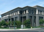
Economy
Mexicana de Aviación operates a San Francisco/Oakland area office on the second floor at 195 East 4th Avenue.[6]
Prominent companies based in San Mateo
- Actuate Corporation
- Admob
- Bills.com
- Blizzard North, a division of Blizzard Entertainment formerly located in San Mateo
- Capcom (American division)
- Con-way
- DotNetNuke
- DemandTec, Customer Demand Management
- Fisher Investments
- Franklin Templeton Investments
- Freedom Debt Relief
- Glu Mobile, global publisher of mobile games.
- GreenPlum, data warehousing and analytics
- Hudson Entertainment (Hudson Soft's USA subsidiary)[7]
- Keynote Systems
- Laszlo Systems
- NetSuite
- NexTag
- Oodle
- PBwiki
- Redbana[8]
- Salesforce.com
- Sling Media, Inc.
- Stratogent
- SuccessFactors
- TradeBeam
- Vendio
- Webcor Builders
- Wikia, Inc.
- YouTube, formerly located in San Mateo.
- Zimbra, now a division of VMware.
Education
Primary and secondary schools
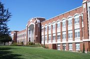
Residents are zoned for schools in the San Mateo Foster City School District and San Mateo Union High School District. Elementary schools comprise Preschool, K-5, Middle and Magnet schools. There are three public high schools: San Mateo, Aragon, and Hillsdale. There is also one private, all-male Catholic high school, Junípero Serra.
Community colleges
The city is home to the College of San Mateo, a community college.
Adult School
The San Mateo Union High School District also hosts an adult school behind the campus of San Mateo High School.[9]
Public libraries
The City of San Mateo operates the Main Library, the Hillsdale Library, and the Marina Library.[10]
Public transportation
SamTrans[11], AC Transit[12] (Transbay service) and Caltrain are public transit providers in San Mateo. See public transportation in San Mateo County for more details.
Prominent places
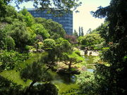
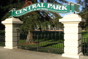
The San Mateo Performing Arts Center, located on San Mateo High School, is one of the largest theatres on the peninsula outside of San Francisco. The College of San Mateo is also located here and is home to radio station KCSM. Bay Meadows horse-racing track was torn down in 2008. The Japanese Tea Garden and San Mateo Arboretum in Central Park are of interest. U.S. Route 101, Interstate 280, and State Route 92 pass through San Mateo. One of its sister cities is Toyonaka, Japan, which the Japanese garden in Central Park was made to commemorate.
Media
- San Mateo Daily Journal - Newspaper
- San Mateo Daily News - Newspaper
- San Mateo County Times - Newspaper
- KCSM (FM) - National Public Radio outlet
- KCSM-TV - PBS television station
- The San Mateo Hi - Student-run newspaper
- The Aragon Outlook - Student-run newspaper
- The Hillsdale Scroll - Student-run newspaper
Sister cities
San Mateo has three sister cities, as designated by the Sister Cities International, Inc.:[13]
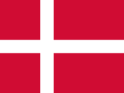 Varde, Denmark
 Toyonaka, Japan
 San Pablo City, Philippines
See also
- The Carey School
- Pier 1 Imports - founded 1962, in San Mateo
- Electronic Arts - originally headquartered in San Mateo
References
- ↑ "US Gazetteer files: 2000 and 1990". United States Census Bureau. 2005-05-03. http://www.census.gov/geo/www/gazetteer/gazette.html. Retrieved 2008-01-31.
- ↑ Western Regional Climate Center website (http://wrcc.dri.edu/)
- ↑ "American FactFinder". United States Census Bureau. http://factfinder.census.gov. Retrieved 2008-01-31.
- ↑ "San Mateo City, California: Income in the Past 12 Months (In 2007 Inflation-Adjusted Dollars)". U.S. Fact Finder. U.S. Census Bureau. http://factfinder.census.gov/servlet/STTable?_bm=y&-context=st&-qr_name=ACS_2007_1YR_G00_S1901&-ds_name=ACS_2007_1YR_G00_&-CONTEXT=st&-tree_id=307&-redoLog=false&-_caller=geoselect&-geo_id=16000US0668252&-format=&-_lang=en.
- ↑ "Will Gerrymandered Districts Stem the Wave of Voter Unrest?". Campaign Legal Center Blog. http://www.clcblog.org/blog_item-85.html. Retrieved 2008-02-10.
- ↑ "USA/Canada Offices." Mexicana de Aviación. Retrieved on January 28, 2009.
- ↑ "Corporate information." Hudson Soft. Retrieved on July 12, 2010.
- ↑ "Gaming firms scoop up San Mateo office space." San Francisco Business Times. Retrieved on November 18, 2009.
- ↑ Official Website of the San Mateo Adult School.
- ↑ "Library Locations & Hours." City of San Mateo. Retrieved on October 6, 2009.
- ↑ Transit.511.org
- ↑ Transit.511.org
- ↑ Sister Cities information obtained from the Sister Cities International, Inc. (SCI)." Retrieved on July 25, 2007.
Further reading
- Alan K. Brown, Place names of San Mateo County, San Mateo County Historical Association, published by Glen Luck, San Mateo, Ca. (1975)
- Mission Dolores, San Francisco, Registers of Baptisms and Deaths, (1789)
- "San Mateo: A Centennial History", By Mitchell P. Postel; Scottwall Associates, Publisher, San Francisco; 1994.
ISBN 0-942087-08-9 (HBK) - U.S. Bureau of Land Management BLM, FN 254-21 (1853)
External links
- City of San Mateo website
- San Mateo CERT (Community Emergency Response Team)
- San Mateo Public Library
|
||||||||||||||||||||
|
|||||||||||||||||||||||||
|
|||||||||||||||||||||||